


CONNECTED COMMUNITY
COMPREHENSIVE PLAN: CHAPTER 6
OVERVIEW
The condition of an area’s transportation system impacts the community’s quality of life and economic vitality. Great cities such as Meridian need better connectivity, a range of transportation options, and vibrant multi-modal corridors. These communities understand that transportation technology is changing rapidly, and cities must plan accordingly, allowing for flexibility to address new types of vehicles, autonomous and shared vehicles, transit, walking, and biking. Appropriate mix and intensity of uses must be integrated to make alternative modes of transportation viable. As a growing community, new businesses and residents are looking for safe and efficient choices that represent a community ready to embrace the future. At the center of transportation, Meridian knows that it must join with partner agencies that plans for the functional integration of land use and infrastructure to create the community residents’ desire.
The Plan promotes a Connected Community that sets the stage for different modes of travel while ensuring broad system functionality, safety, and efficiency. The Plan creates the framework for accommodating all modes of transportation by planning, designing, and developing land use and corridors that support pedestrians, bicycles, transit, motor vehicles, and new forms of mobility.
As part of the Connected Community Vision, the following element is included in this chapter:
CONNECTED COMMUNITY VISION
A community of safe and efficient transportation.
TRANSPORTATION AND STREETS
INTRODUCTION
The Transportation and Streets element prioritizes regional coordination to meet the existing needs for adequate transportation service, while planning for and accommodating future growth as efficiently as possible.
BACKGROUND
As Meridian does not have roadway authority of its own, providing adequate transportation service across all modes requires significant coordination with transportation agencies in the region. The City works closely with the Ada County Highway District (ACHD), the Idaho Transportation Department (ITD), Valley Regional Transit (VRT), and the Community Planning Association of Southwest Idaho (COMPASS) to make sure residents’ and business’ transportation needs are met. In addition to planning for future transportation needs, the roadway infrastructure already developed will require funding for maintenance, rehabilitation, and expansion.
Beyond supporting traditional motor vehicle use, the City continues to maintain and promote alternative methods of transportation. From sidewalks for pedestrians and regional multi-modal pathways to public transportation efforts, the City recognizes that supporting diversity and providing modal choice helps to not only promote a healthier, happier community, but reduces over-use of roadways by passenger vehicles. Through cooperation with regional partners, Meridian supports and promotes developments that provide transportation options for everyone.
The City also recognizes that while it does not directly control the roadways or public transportation service, its land use decisions have a direct effect on the effectiveness and sustainability of how these systems are able to function. The future land-uses in Chapter 3 have been developed to support existing area transportation plans, as well as to guide the future build-out and operation of the different systems into the long-range future.
Idaho is one of two states that do not currently have a dedicated funding source for public transportation. The ability of the City to act alone in remedying this situation is limited since State law does not allow the City’s residents to vote to tax themselves through a local-option sales tax. Realizing that the current system is neither sustainable nor able to grow indefinitely, this Plan assumes that State legislature will act to resolve this issue at some point in the future.
Regional Transportation Plan
Communities in Motion 2040 2.0 (CIM 2.0) is the region’s long-range transportation plan. However, CIM is more than just a transportation plan; the intent of CIM is to further integrate land use and transportation planning.
Transportation and Land Use Integration
To better connect transportation planning and land use decisions, ACHD and the cities in Ada County use the Transportation and Land Use Integration Plan (TLIP), which envisions livable streets for tomorrow and depicts how streets should look and function in the future. The goal is to create a roadway network that balances the needs of all roadway users-motorists, pedestrians, cyclists, transit riders, and people with disabilities, with streets that complement the built environment. Because a one-size-fits-all program for roadway construction does not respond to either the land use or transportation needs of the community, the City and ACHD have agreed to join together the land use plans of the City with the transportation plans of ACHD. A component of TLIP is the Master Street Map (MSM). This map is a companion component to the City’s Future Land Use Map, and indicates the types of complete street facilities and right-of-way necessary to support the adjacent land uses.
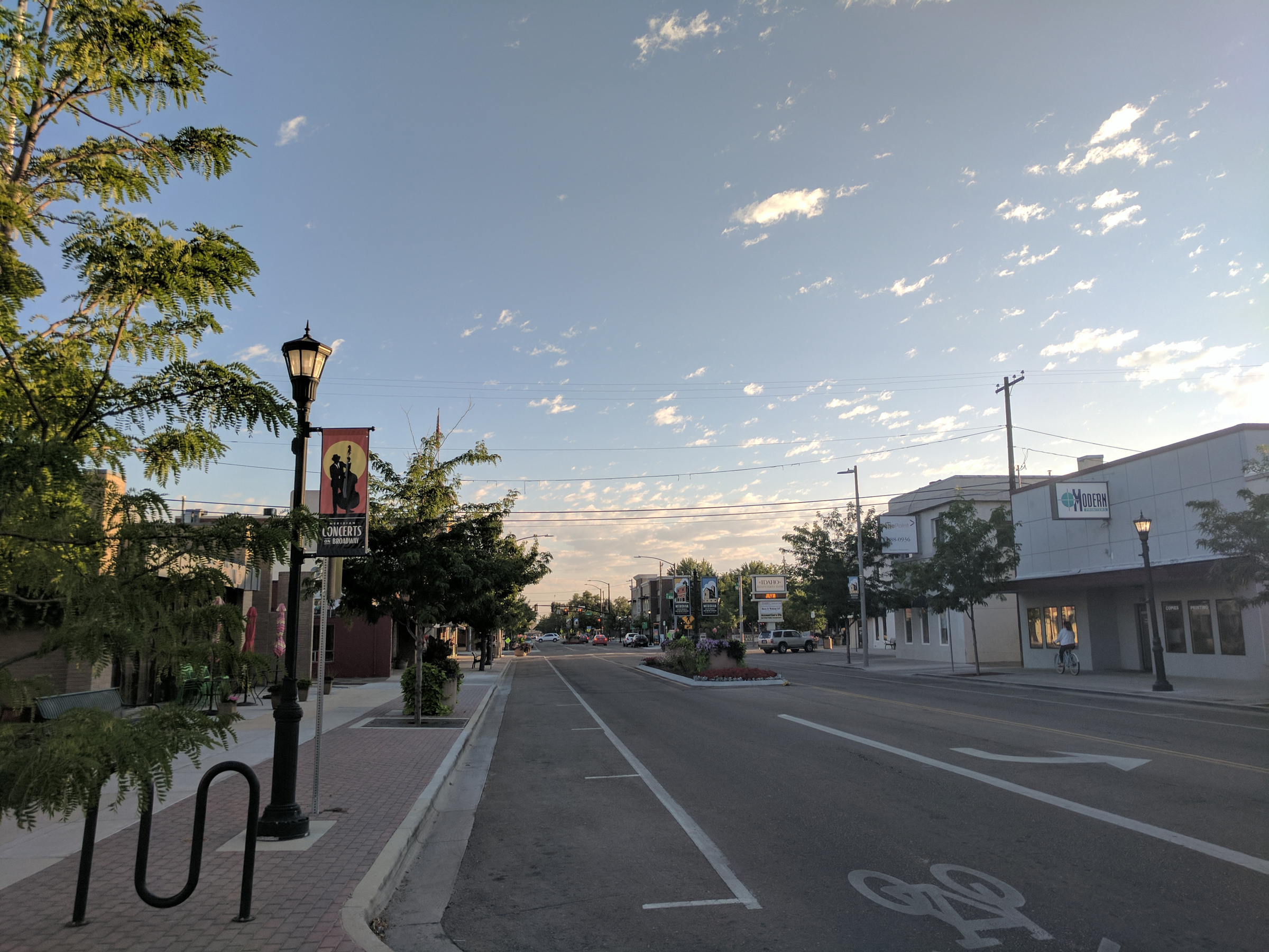
Downtown Transportation Network
The City envisions a multi-modal transportation network throughout the city, but there are several plans and studies that more specifically evaluate where and how various opportunities for access can and should be provided in downtown. The Downtown Meridian Transportation Management Plan was developed by ACHD with insight provided by the City to propose solutions to circulation-related challenges in downtown Meridian. While most of the work in this plan has been completed, two projects remain: the 3rd Street and Commercial Street extensions.
To increase connectivity and facilitate additional north-south traffic movement downtown, the City will work through development and redevelopment to preserve right-of-way and construct East 3rd from Franklin Road to Fairview Avenue per the alignment identified in the subsequent 2009 East 3rd Street Extension Alignment Study Report.
Adopted in 2012, the City worked with the ACHD to develop a plan for future enhancements of pedestrian and bicycle facilities downtown. The Downtown Meridian Neighborhood Pedestrian and Bicycle Plan is intended to inform how investments in the network can best be made to realize a safe, convenient and accessible area to bike and walk.
The City has also adopted the Downtown Meridian Street Cross-section Master Plan, which is intended to preserve for and work towards long-term connectivity and streetscape improvements. Finally, the railroad passes east-west through the middle of downtown, and is the subject of several studies and on-going local and regional planning efforts to share the corridor, currently used for freight, for uses ranging from regional pathways to public transportation.
Alternative Transportation
The City works with transportation providers to improve access to employment opportunities, medical appointments, recreational activities, and education. Local partnerships provide opportunities to create connections for drivers as well as non-drivers.
Valley Regional Transit (VRT) is the regional public transportation authority for Ada and Canyon counties and is responsible for coordinating transit service and implementing a regional public transportation system. VRT operates the bus service in this area under the name ValleyRide and works in close coordination with other regional partners to plan for enhancements to the public transportation system.
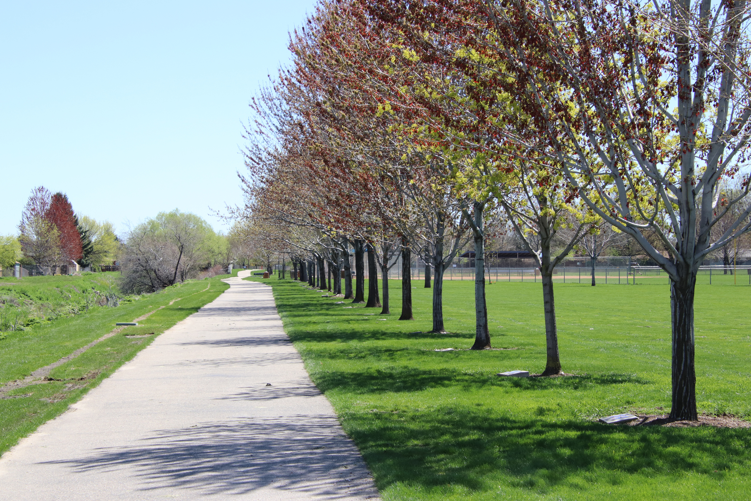
Pathways that encourage use by bicyclists and pedestrians can decrease road congestion and add to the community’s quality of life. Meridian continues to develop a pathway network that identifies a core system of pathways based on the existing canal system within the City of Meridian. This system is augmented by the developer-implemented pathways that will provide connections to and through many residential areas while creating larger citywide loops. This system gives community members a wide variety of pathway options throughout the City and to other parts of the metropolitan region.
The ACHD has adopted a plan that seeks to create and connect bicycle lanes throughout Ada County, to create a bicycle network that provides a designated bicycle facility within a quarter-mile from 95 percent of the residents in the County. The City, as part of development review and ACHD roadway projects, look to expand bicycle opportunities throughout the City.
Meridian Transportation Commission
The City has an appointed transportation commission of nine residents, along with six non-voting ex-officio members, that advises the City on transportation related issues. The Meridian Transportation Commission works with City staff and agency partners to set the City’s priorities and communicate them to the transportation agency partners. It also makes recommendations to the City regarding its own policies and actions.
For additional information, refer to the following resources:
- Existing Conditions Report; Addendum to the City of Meridian Comprehensive Plan | City of Meridian Webpage
- Meridian Pathway Master Plan | WCity of Meridian Webpage
- Communities in Motion 2040 2.0 | City of Meridian Webpage
- ValleyConnect 2.0 | City of Meridian Webpage
- Transportation and Land Use Integration Plan | City of Meridian Webpage
- Roadways to Bikeways Bicycle Master Plan | City of Meridian Webpage
- Downtown Meridian Neighborhood Pedestrian and Bicycle Plan | City of Meridian Webpage
- Downtown Meridian Transportation Management Plan | City of Meridian Webpage
- Downtown Meridian Street Cross-section Master Plan | City of Meridian Webpage
- Airport - Overland Corridor Study | City of Meridian Webpage
Policy Table
Policies by Topic
| ID | Policy | Section | Section Symbols | Type | Chapter | Priority | Lead | Support |
|---|---|---|---|---|---|---|---|---|
| 6.00.00 | Chapter 6 | Connected Community | g | 6 | ||||
| 6.01.00 | Facilitate the efficient movement of people and products to and from the City. | Transportation and Streets | g | G | 6 | CD, PR | CD, FI, MO, PR, PW | |
| 6.01.01 | Support multi-modal and complete-street transportation improvements. | Transportation and Streets | g | O | 6 | CD, PR | FI, MO, PR, PW | |
| 6.01.01A | Work with the Union Pacific Railroad, Watco Companies and other interested stakeholders to preserve and protect the existing Boise Cut-off rail corridor as a multi-use corridor, including freight. | Transportation and Streets | g | A | 6 | High | CD | PW |
| 6.01.01B | Support Valley Regional Transit's (VRT) efforts to construct multi-modal transit centers in areas of high commercial activity and employment as well as areas with transit-supportive residential densities. | Transportation and Streets | g | A | 6 | On-going | CD | PW |
| 6.01.01C | Improve ingress and egress opportunities for all modes of transportation in Downtown. | Transportation and Streets | g | A | 6 | On-going | CD | |
| 6.01.01D | Pursue construction of the City's pathways network. | Transportation and Streets | g | A | 6 | Very High | PR | FI, MO |
| 6.01.01E | Pursue bicycle routes/lanes/paths on roadways that will be appropriate for a wide range of ages and abilities. | Transportation and Streets | g | A | 6 | On-going | CD | |
| 6.01.01F | Work with transportation providers to implement transportation plans, projects, and studies. | Transportation and Streets | g | A | 6 | On-going | CD | PW |
| 6.01.01G | Develop criteria for plan review in determining whether a development proposal is safe, accessible, and comfortable for pedestrians and cyclists. | Transportation and Streets | g | A | 6 | High | CD | |
| 6.01.01H | Require pedestrian access connectors in all new development to link subdivisions together and to promote neighborhood connectivity as part of a community pathway system. | Transportation and Streets | g | A | 6 | On-going | CD | PR |
| 6.01.01I | Work with Ada County Highway District (ACHD) to identify gaps in the sidewalk system and pursue sidewalk construction for existing substandard streets. | Transportation and Streets | g | A | 6 | On-going | CD | PW |
| 6.01.01J | Encourage new development to include buffered sidewalks, a sidewalk separated from the motor vehicle lane by a planter strip, especially on collector and arterial roadways. | Transportation and Streets | g | A | 6 | On-going | CD | |
| 6.01.02 | Enhance existing transportation systems. | Transportation and Streets | g | O | 6 | CD | PW | |
| 6.01.02A | Work with transportation partners to include Meridian's highest priority transportation projects within their plans and budgets. | Transportation and Streets | g | A | 6 | On-going | CD | PW |
| 6.01.02B | Reduce the number of existing access points onto arterial streets by using methods such as cross-access agreements, access management, and frontage/backage roads, and promoting local and collector street connectivity. | Transportation and Streets | g | A | 6 | On-going | CD | PW |
| 6.01.02C | Require new development to establish street connections to existing local roads and collectors as well as to underdeveloped adjacent properties. | Transportation and Streets | g | A | 6 | On-going | CD | |
| 6.01.02D | Consider needed sidewalk, pathway, landscaping, and lighting improvements with all land use decisions. | Transportation and Streets | g | A | 6 | On-going | CD | PW |
| 6.01.02E | Consider incomplete and underserved roadways and timing of necessary roadway improvements in all land use decisions. | Transportation and Streets | g | A | 6 | On-going | CD | |
| 6.01.02F | Improve coordination with ACHD, ITD, VRT, COMPASS, and developers in addressing transportation issues and needs before public hearings, including having school and transportation agency comments in with adequate time to allow for review by the City before a decision is made on a land-use application. | Transportation and Streets | g | A | 6 | On-going | CD | PW |
| 6.01.02G | Work with the Transportation Commission and transportation partners to implement needed neighborhood traffic calming and address safety concerns. | Transportation and Streets | g | A | 6 | On-going | CD | PW |
| 6.01.02H | Work with transportation partners to establish and implement a system of performance measures to gauge whether transportation goals and objectives are being realized. | Transportation and Streets | g | A | 6 | On-going | CD | |
| 6.01.02I | Pursue the extension of Idaho Ave. and/or Broadway Ave. to Commercial Dr. and the extension of East 3rd St. from Fairview Ave. to Pine Ave. in Downtown. | Transportation and Streets | g | A | 6 | On-going | CD | |
| 6.01.02J | Pursue the extension of Overland Road into Canyon County, consistent with the 2011 Airport-Overland Corridor Study. | Transportation and Streets | g | A | 6 | On-going | CD | |
| 6.01.02K | Pursue the expansion of US 20/26; the development of an overpass of I-84 at Linder Road; the extension of SH-16 from US 20/26 to I-84; and SH-55 and SH-69 corridor improvements. | Transportation and Streets | g | A | 6 | On-going | CD | |
| 6.01.02L | Work with ACHD to implement projects from the 2012 Downtown Meridian Neighborhood Pedestrian and Bicycle Plan. | Transportation and Streets | g | A | 6 | On-going | CD | |
| 6.01.02M | Work with transportation agencies and private property owners to preserve transportation corridors, future transit routes and infrastructure, road, and highway extensions, and to facilitate access management. | Transportation and Streets | g | A | 6 | On-going | CD | PW |
| 6.01.02N | Coordinate with ACHD to more carefully examine the appropriateness of roundabouts with intersection improvements in relation to pedestrians and other users. | Transportation and Streets | g | A | 6 | On-going | CD | PW |
| 6.01.03 | Provide the most efficient transportation network possible. | Transportation and Streets | g | O | 6 | CD | ||
| 6.01.03A | Work with ITD and ACHD to establish truck routes and design routes appropriately for their contexts. | Transportation and Streets | g | A | 6 | On-going | CD | |
| 6.01.03B | Require collectors consistent with the ACHD Master Street Map (MSM), generally at/near the mid-mile location within the Area of City Impact. | Transportation and Streets | g | A | 6 | On-going | CD | |
| 6.01.03C | Require the public street system to be continuous through each mile section, avoiding long, straight stretches. | Transportation and Streets | g | A | 6 | On-going | CD | |
| 6.01.03D | Consider ACHD's Master Street Map (MSM), Complete Streets Policy and the Transportation and Land Use Integration Plan in all land use decisions. | Transportation and Streets | g | A | 6 | On-going | CD | |
| 6.01.03E | Participate in the development of the Regional Transportation Plan (CIM 2.0) and Transportation Improvement Program (TIP). | Transportation and Streets | g | A | 6 | On-going | CD | PW |
| 6.01.04 | Encourage new and alternative transportation systems that reflect changes in technology and lifestyles. | Transportation and Streets | g | O | 6 | CD, PR | CD, MO, PR | |
| 6.01.04A | Support efforts to evaluate and plan for future transportation services such as public transit, on-demand services, autonomous and shared vehicles. | Transportation and Streets | g | A | 6 | On-going | CD | |
| 6.01.04B | Develop and implement agreements with irrigation districts and the Union Pacific Railroad to allow for bike/pedestrian pathways. | Transportation and Streets | g | A | 6 | Medium | PR | CD, MO |
| 6.01.04C | Work with transportation partners to identify and promote strategies for reducing reliance on the single-occupant automobile. | Transportation and Streets | g | A | 6 | Low | CD | |
| 6.01.04D | Work with COMPASS and VRT to expand public transportation in Meridian. | Transportation and Streets | g | A | 6 | On-going | CD | |
| 6.01.04E | Integrate new technologies (e.g., connected and automated vehicle technology, micro-mobility options) to increase efficiency, safety, and opportunities of transportation users. | Transportation and Streets | g | A | 6 | On-going | CD | |
| 6.01.04F | Consider and mitigate undesired impacts of emerging transportation and delivery technologies. | Transportation and Streets | g | A | 6 | On-going | CD | |
| 6.01.05 | Work with transportation partners to identify locations for future park & ride lots, shuttle buses, and/or transit stations. | Transportation and Streets | g | O | 6 | CD | PW | |
| 6.01.05A | In coordination with VRT and COMPASS, explore grants and other funding opportunities to provide incentives for developers to locate public transit infrastructure within areas planned for transit. | Transportation and Streets | g | A | 6 | On-going | CD | |
| 6.01.05B | Work with VRT in developing design guidelines for transit stations. | Transportation and Streets | g | A | 6 | On-going | CD | |
| 6.01.05C | Support alternative public and private sector funding opportunities for transportation investment. | Transportation and Streets | g | A | 6 | On-going | CD | PW |
Note: The Policy Table above depicts policies for this Chapter only. Too review policies for the entire Plan, see the Implementation Table.


